Poverty Point

Ingenuity, artistry come together in ‘America’s first city,’ Louisiana’s only World Heritage Site
Thousands of years before the glittering glass skyscrapers of Manhattan rose, Native Americans in northeast Louisiana built Poverty Point, a complex of mounds and earthworks that some call America’s first city.
Archeologists don’t know what the builders called the complex or themselves. The builders left clues about their construction methods and everyday life, but there’s no evidence of written or pictorial language. The complex is named after a plantation that occupied part of the site in the 1800s.
Archeologists believe as many as 10,000 people gathered there at one time — more than the entire population of West Carroll Parish now. Artifacts point to a thriving, sophisticated community.
“For its time period, the Late Archaic time period, it is the largest and most complex site we know of,” says Diana Greenlee, the University of Louisiana station archeologist at World Heritage Site. “We tend to say it would have been the New York City of its day.”
People started living on the Poverty Point site about 1700 BCE.
Over a 600-year span — until about 1100 BCE — they built the mounds and earthworks, said Mark Brink, site manager at Poverty Point.
“The big thing is that none of this was built by farmers. The ancient peoples here were hunters, fishers and gatherers, and that means that this is one of the most significant sites in North America. As far as we can tell, there are no greater monuments built by hunters and gatherers in the world,” Brink explained.
That distinction is one of the reasons Poverty Point was designated a World Heritage Site by the United Nations Educational, Scientific and Cultural Organization in 2014. It’s the only World Heritage Site in Louisiana.
Archeologists began documenting Poverty Point in the early 20th century, but formal preservation efforts started only 60 years ago. In 1962, Congress declared Poverty Point a National Historic Landmark. In 1972, Louisiana bought the property on which Poverty Point sits and opened it to the public.
Today, visitors can stroll through the same complex that flourished more than 3,000 years ago.
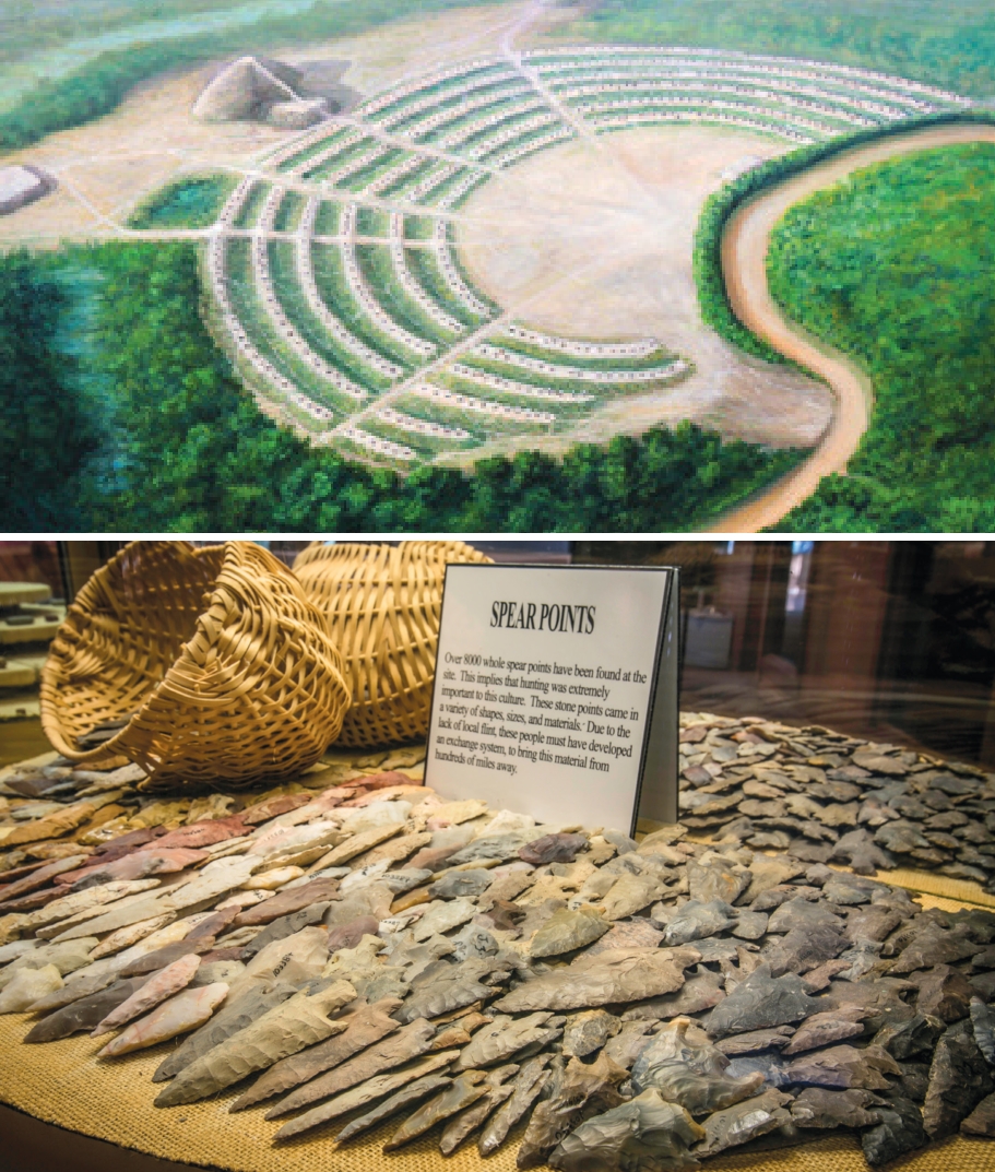
“There’s the ceremonial core of the site, the stuff that is artificial or man-made, that covers about 300 acres, between a central plaza, six semi-oval or semi-elliptical ridges and a series of five mounds.
There’s also another mound that was built by another culture,” Brink said.
The Native Americans who built Poverty Point chose a location that any modern contractor would envy — the Macon Ridge, a natural rise overlooking the Mississippi River floodplain. Bayou Macon, which skirts the site, provided food and connected the site to a network of rivers Native Americans traveled.
Poverty Point’s builders were accomplished engineers, preparing the building site and mixing soils to erect stable, erosion-resistant earthworks.
Mound A, rising 72 feet in the air, still dominates the site. Archaeologists believe it was built in as little as 90 days, a massive undertaking for construction crews who used basketloads of dirt to create the structure. Each basket, probably woven from cane, held about 50 pounds of soil.
“(Archeologists) took soil cores from the mound and cleared a face of a mound to see the profile. They could see individual basket loads of dirt,” Greenlee says.
“It’s beautiful, almost like a mosaic. Each basket load had dirt from different locations. There were lumps of dark topsoil, lumps of gray, silty soil that formed in depressions where water sits, and the general subsoil, which is an orangish-brownish red. You can really see where one has been piled on top of another.”
Research by T.R. Kidder, a professor of anthropology at Washington University in St. Louis, points to the conclusion that the mounds and earthworks at Poverty Point were built in record time.
Kidder has studied Poverty Point extensively since his first visit in 1983. He and his team have excavated and produced the first full-scale topographic map of the site and conducted geological and soil studies at the site and nearby locations to understand long-term environmental change in the region.
He and a team of graduate students visited Poverty Point in June to look for clues about why the complex was built. They used radiocarbon dating, examined soil under a microscope and tested the magnetic properties of soil samples to answer their questions.
“I can make a case that the ridges and mounds were built quickly and built at the end of the site’s occupation history. I think — but again this isn’t proof — that the site was a place of pilgrimage that was visited by people from across much of the East, who came to the site to worship and to do so because their world was disordered because of natural environmental and climate change,” Kidder said.
“In their religion, people were responsible for doing the right things when the world wasn’t properly ordered, and coming together at this place at this time was a response, much as people go to Mecca, or Lourdes, or Jerusalem, as a way of expressing devotion, supplication and to do the right thing by their moral code. This is all speculative but fits the facts and our understanding of Native behavior.”
Kidder believes Poverty Point was a spiritual center first, then became an economic and cultural center as people gathered there.
“We see religion and ideology — the desire to do the right thing as expressed in a relationship with all living things and the world around them — as a motivating factor. Economics — trade or exchange, sharing ideas and information, etc. — was an outcome of doing the right thing, but not the cause,” he said.
Artifacts from Poverty Point hint at trade networks spanning hundreds of miles. There’s no stone near the complex, so people had to import it. Archaeologists have uncovered tools and objects made of stone traced to Georgia, Alabama, Arkansas and Missouri.
“Probably over 70 tons of stones were brought in from greater distances. Copper found at the site appears to be from the Great Lakes area and the Appalachians,” Greenlee said. “We also have pottery from Florida.”
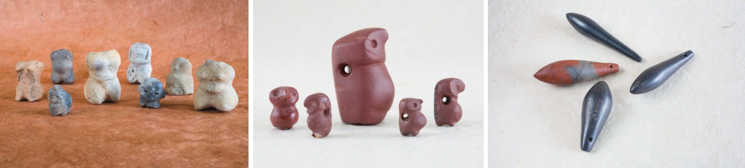
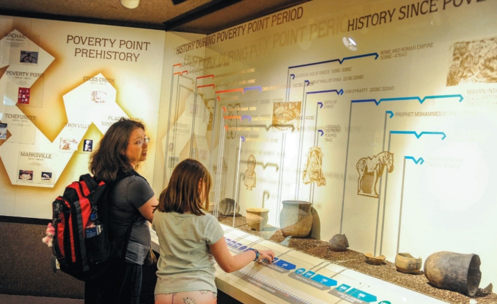
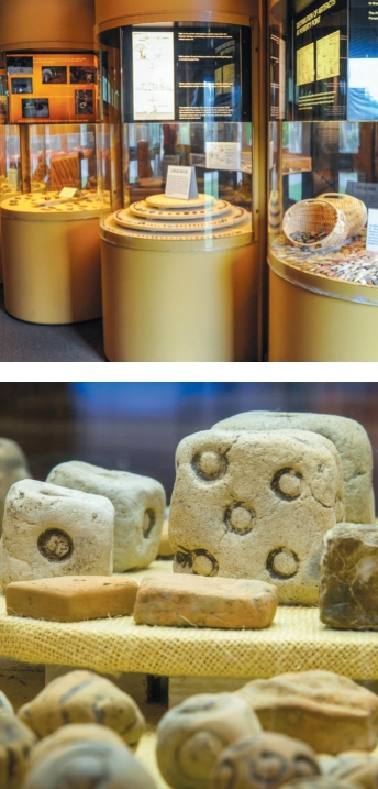
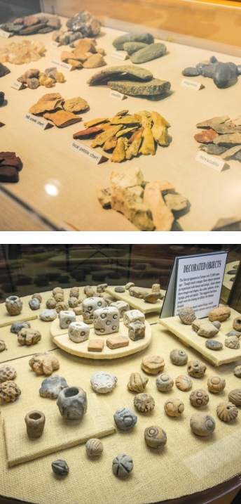
A museum at the complex displays many artifacts, ranging from spear points to soapstone bowls and beads made from various materials. People living at or visiting Poverty Point also created female-shaped figurines from clay and fired them to harden them. Exquisitely carved owl pendants are associated with Poverty Point, but Greenlee said more of those have been found elsewhere than at the site.
Among the most unique artifacts are small, fired clay balls called Poverty Point Objects (PPOs). People used these for the original pit barbecue. After digging a pit, they heated the clay balls in a fire. After the fire died down, they added game or fish, covered the pit with dirt and let the food slow cook.
Jacob Walter, the first American visitor to write about the complex, noticed the Poverty Point Objects. In the 1830s, he was chasing a tip about lead ore when he stumbled across the complex, which he called “the site of an old Indian town” in his diary.
He saw “fragments of crockery” and “clay balls” on top of the ground, then measured the mounds before moving on.
Artifacts offer clues to everyday life at Poverty Point. Based on the number of PPOs found at the complex, people cooked often, a sign that food was abundant. The animal remains found at the site are primarily fish. Archaeologists have found traces of charred food indicating that Poverty Point residents ate nuts, persimmons, pawpaws, muscadine grapes and starchy roots.
At least some of the residents lived on the ridges, probably in homes with woven walls covered by a layer of baked mud. There are also distinct work sites — for example, a tool manufacturing location — in and near the complex.
Technologies such as ground-penetrating radar, soil magnetometry and electrical resistance surveying are helping researchers pinpoint new areas of interest. With each investigation, archeologists expand our understanding of the accomplished artisans and builders at Poverty Point.
“The next time we stick a shovel in the ground, the story will change, at least a bit. And that is why we keep going back and why the site continues to excite and fascinate me,” Kidder says.
Despite the research, there are no definitive answers to the big questions, including why people abandoned Poverty Point. One theory points to the environmental and climate change that may have led Native Americans to build Poverty Point. Increased rain and flooding may have upended travel networks or made the site hard to reach, prompting people to move on.
There’s no way to tell where the people of Poverty Point went after they left.
Other Native American groups in the region may have absorbed them. No oral or written history among the Native American tribes linking them to Poverty Point.
“There’s a general recognition that the people of Poverty Point were ancestors, but not to a specific tribe,” Greenlee said.
Greenlee first learned about Poverty Point as an undergraduate student at the University of Washington. She never dreamed she would work there.
When the station archaeologist job became available, she jumped on the opportunity. Even after almost 20 years, she remains amazed by what the people of Poverty Point achieved.
“People tend to have this idea that those who lived by hunting and gathering were just barely eking out survival,” Greenlee said.
“At Poverty Point, people had time to participate in these cooperative endeavors, build these huge monuments and create beads and other artifacts that are simply works of art. They were engineers. We’ve got giant mounds that have lasted more than 3,000 years. That is spectacular.”